The other day I mentioned this short article I wrote in JCDecaux trend report. It was about how skateboarders "read" space, make decision about where they do skateboard or to hang out with peers. In a sense, it's about "social navigation" and what sort of "footprints in the snow" matter for skateboarders. I dug up some examples from my city ventures below. Choosing a skateboard spot according to the physical aspect of the place
For instance, in Niteroi (Brasil), that curved sidewalk is definitely an invitation to skate it:

This bench in Zürich (Switzerland) is also an obvious point of interest (from the physical point of view) but the presence of wax also attests that OTHERS are using it as a spot. The place can also be more than a physical spot as the presence of wax indicates it marking by a community. It reveals the appropriation by a click of skateboarders (and the likelihood to find them here on saturday afternoon)

Skatespot approval or how places are validated for certain activities
This "thumb-up" stickers found in front the of the University of Geneva indicates the approval of the spot by a community of skater (in that case a local shop/community):
Skateboard map
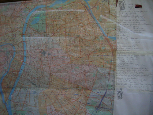
The usual paper map, for example in Lyon (France) found in a shop called Wallstreet, that depicts interesting spots to do skateboarding:
And of course, there is an on-line/participatory version, named freeyourspot, see the example of London (which not really reveal about skateboarding potential there):

Why do I blog this? of course one could use lots of other examples but I find skateboarders a very interesting target group to study spatial behavior, and how they use various techniques (from wax to participatory websites or cell phones). In this post, I tried to update some examples of how skateboarders read/navigate in space.
I find them really interesting examples IMHO of what some would refer to as "situated technologies".

